INFOMAR – Deployment of Moving Vessel Profiler
For Enhanced Oceanographic and Hydrographic Quality Control
By: Vera Quinlan, Kevin Sheehan, Fabio Sacchetti, Tommy Furey - INFOMAR

"The use of the MVP allowed vessel speed to be maintained, reduced the number of line turns required during the survey, and is estimated to have increased the survey coverage and efficiency by 12%."
Thomas Furey
INFOMAR JOINT PROGRAMME MANAGER
MARINE INSTITUTE OF IRELAND
Background
The Integrated Mapping for the Sustainable Development of Ireland’s Marine Resource programme, INFOMAR, is Ireland’s national marine mapping programme. It is the successor to the Irish National Seabed Survey (INSS), and is a joint venture of the Geological Survey of Ireland (GSI) and the Marine Institute (MI), funded by the Department of Communications, Climate Action and Environment.
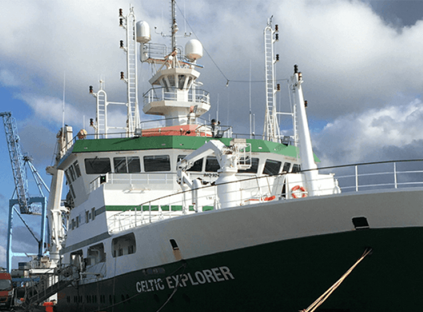
The overarching objective of the INFOMAR programme is to create a range of integrated seabed mapping products for the entirety of Ireland’s offshore waters. In order to achieve this, INFOMAR deploys a range of survey vessels, from small craft operating in the near shore areas to ocean going research vessels such as the R.V. Celtic Explorer and R.V. Celtic Voyager.
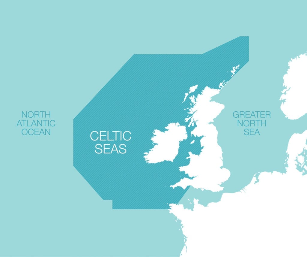
The Celtic Sea
During the last two years, INFOMAR offshore mapping focused on the SE Celtic Sea, an area of importance for shipping, and of significant economic value for fisheries having been designated in 2003 as a Biologically Sensitive Area by the European Commission.
The Celtic Sea is a complex area from an oceanographic perspective with a transition from stratified to mixed water occurring in the eastern extent towards the entrance to the Irish Sea. It tends to be more stable and stratified however with uniform thermocline development and regular seasonal and tidal variability in the central area.
During 2017 survey planning, to better control sound velocity variability in the water column in this challenging area and to improve multibeam data integrity, it was decided to recommission the MVP200 system, which had not been utilized for several years. The specific objectives were to:
- Increase survey efficiency.
- Allow better sound velocity controls on the echo sounders and improve overall data quality.
- Add value to the data set for research collaboration in an important fisheries ground. More specifically, to investigate the nature of internal waves and variability of the thermocline.
With advance instrumentation calibrations and lab support on planning and engineering requirements to recommission the MVP200 provided by AML engineers, followed up by onsite support during mobilisation, the MVP200 was fully operational prior to vessel departure for survey.
The hydrographic survey took place between 21st of July and the 5th of August, with the core Irish scientific team augmented by two international research groups, as part of Ireland’s Atlantic Ocean Research Alliance endeavour on collaboration. Prof. John E. Hughes Clarke led a team from the Centre for Coastal and Ocean Mapping (University of New Hampshire), and students joined from the BEAMS programme in the University of Charleston.
A specific focus of the research led by Prof Clarke is to define methodologies to image and automatically extract the thermocline variability from the underway acoustic imagery (EK60 or Multibeam Water Column (WC) data). The use of the MVP was critical in supporting this research in order to directly measure the location of the top and bottom of the thermocline for comparison with its acoustically imaged depth at the various operational EK60 frequencies. Related research activity also focused on multispectral backscatter analysis, and use of the on-board ADCP to define tidal current regimes.
To facilitate the extent of research undertaken in parallel with the core mapping activities, a complex instrumentation array were configured and synchronised in order to avoid acoustic interferences. In summary the following acoustic array was used.
- Multibeam: EM1002 (95 kHz), EM302 (30 KHz) +WC, EM2040 (200 KHz) + WC,
- Single beams: EK60 (18, 38 and 120 kHz)
- ADCP: Ocean Surveyor (75 kHz)
- Subottom profiler: ECHOES3500 Chirp (1-10 KHz)
Survey Results
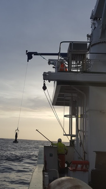
The MVP was deployed off the starboard aft side of the vessel using a boom to keep it as far away as possible from the magnetometer cable. The MVP sensor was deployed almost continuously at survey speed of 7.5-8 knots. The recovery messenger was deliberately located so that the sensor would sit at ~ 4.5-5.5m at normal tow speed. This matches the depth of the EM302 array. The MVP was routinely launched to ~ 10m off the bottom every ~ half an hour. As the survey consisted of ~ 2 hour lines, this typically provided 4-5 profiles during each survey line.
In total over 4000 km of survey line acoustic data were acquired and over 500 MVP casts were taken in 14 days. The use of the MVP allowed vessel speed to be maintained, reduced the number of line turns required during the survey, and is estimated to have increased the survey coverage and efficiency by 12%.
The frequency at which MVPs were taken meant that the sound velocity control for the echo sounders was greatly enhanced.
The preliminary results on thermocline studies indicate a strong correlation between the EK60 data, Multibeam WC data, and the MVP data. With hydrographic effort and accuracy requirements anticipated to rise in the future, an increasing need to better understand oceanographic variability to underpin ecosystem and climate studies, and finally with technology scale down, multi-sensor MVP data acquisition will likely become routine in future ocean mapping initiatives.
Learn how MVP can make a difference for you.
AML’s Moving Vessel Profiler is proven to remove both the technical and financial unpredictability associated with survey operations. With over 130 systems sold, MVP is the market leader in underway profiling systems, and is backed by 20 years of experience and thousands of successful surveys.